


SAVA
The region of SAVA is located in the province of Antsiranana located on the northeastern part Madagascar, at latitude 11° and 15° S, and longitude 47° and 50° E. It is a territory covering 24,149 km2 or 3.6% of the entire Big Island. It borders the region of DIANA in its western part and those of Sofia and Analanjirofo in its southern part. The region has access on its eastern part to the Indian Ocean. The region is composed of 4 districts: Sambava, Antalaha, Vohémar and Andapa. The name of the region comes from the initials of the districts that compose it. In all, it is composed of 79 communes.
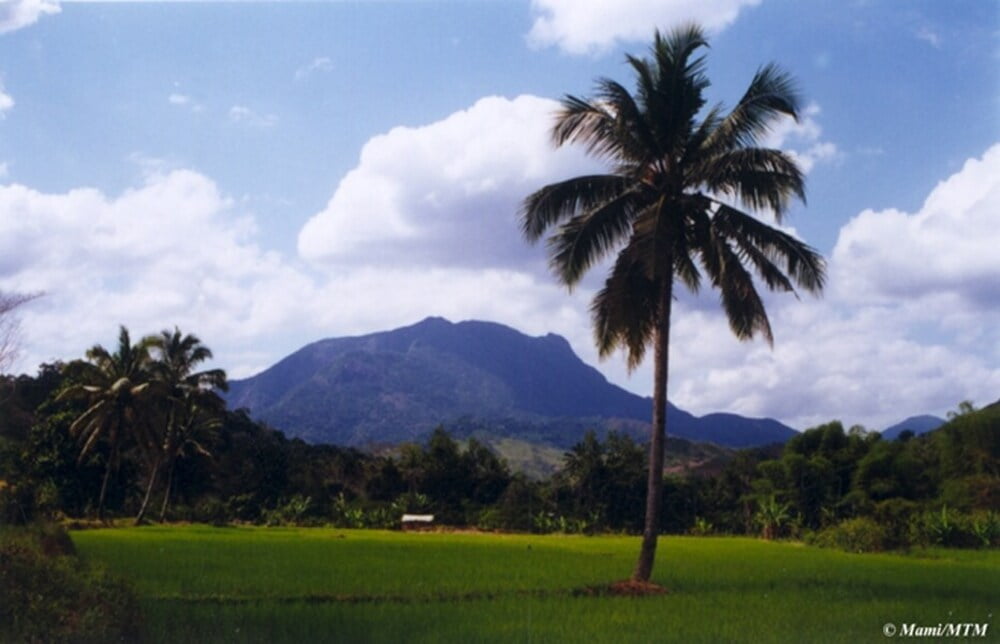
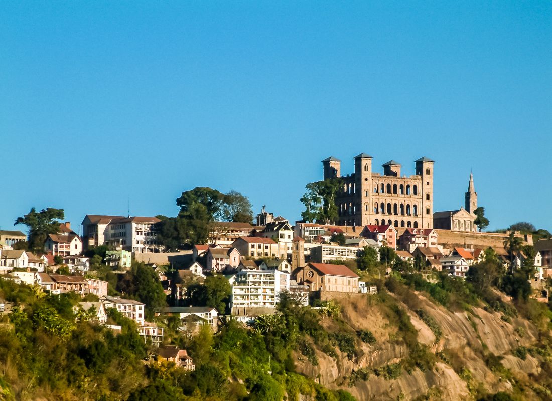
Sambava is the capital of the region and is located 1194 km from Antananarivo. The north-eastern zone of Madagascar constitutes a massive ensemble which is marked by rapid contact and abrupt between the highlands and the sea. From a geomorphological point of view, the region juxtaposes Various forms: volcanic, quartzic and crystalline.
- The reliefs of the base: they correspond essentially to specific tectonic units. The tectonic and orogenic movements affecting the landmass, followed by repetitive volcanisms of the late Tertiary and Quartenary have set up reliefs of varied: plateau, horst, graben. Thus, the faults cut this region into massive blocks vigorously dissected by erosion.The Makira plateau and the Masoala peninsula are horsts framing the graben of Antongil Bay;
- Sedimentary basins: this area is characterized by basement-sedimentary contact. The volcanism has caused many lakes and depressions to appear. The Ankaibe basin extends widely and offers excellent cash crop area.
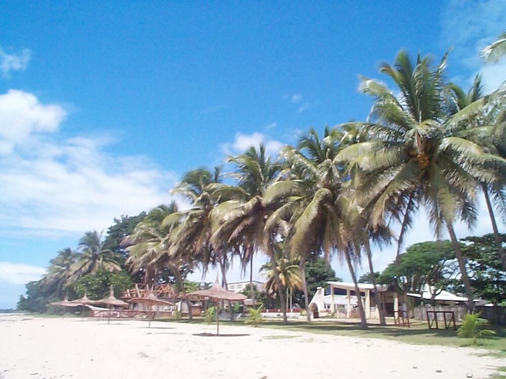
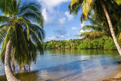
The coast: these are the coasts with high sea cliff at more than 1500 m altitude located at the level of Cape Masoala and Antongil Bay. This is where the continental shelf takes a major extension covering 2,750 km2 and 25 miles wide. Cape Masoala is surrounded by many islets. The coast is dotted with dune bulges and vegetation adapted to tropical coastal environments. Meager mangroves are located in rare places. In general, the region is subject to a tropical climate characterized by an alternation of a cool and dry season from May to November and a wet and hot season from December.
Temperature variations are not very noticeable for the region as a whole. January and/or February records the highest heat and the coolest months are July and August. In Sambava, Antalaha and Vohémar, temperatures range from 18°C to 31°C. The thermal amplitude is respectively 12.8°C, 10.3°C and 9.4°C. Andapa has an average annual temperature ranging from 18.3 °C to 25.2 °C. Thermal amplitude it is 6.9 °C higher because of its relatively high altitude. We can even talk about real winter because an absolute minimum of 7.8 ° C would have been recorded in a certain month of August.
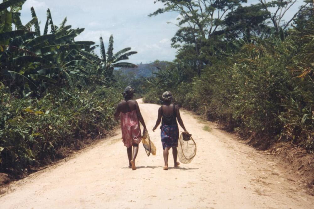
According to the monograph of the region in 2003, in Antalaha, Sambava and Andapa, the Tsimihety and the Betsimisaraka, two neighbouring ethnic groups, make up 75% and 57% respectively.
and 75 per cent of the population. In Vohémar, 60% of the inhabitants are Sakalava and 30% Tsimihety. The Antaimoro make up 15%, 22% and 17% of immigrants respectively in Antalaha, Sambava and Andapa. These are mainly settled in rural areas as farmers where sometimes sees entire villages like Antafonoviana, Ambodivoangibe populated almost exclusively by Antaimoro. Nationals of the Great South (Antandroy) are generally involved in the security sector and to a lesser extent small trades. The two main ethnic groups of the highlands (Merina and Betsileo) are arriving in ever-increasing numbers, mainly as than traders.
SAVA is the most important region green of Madagascar with a dense rainforest of medium altitude spreading over the entire eastern part. The region has two national parks Masoala and Marojejy, and the special reserve of Anjanaharibe South.In Masoala, the forest meets the sea. A feat of nature! In fact, it is very rare that the primary forest descends from more than 1 300 m altitude to the sea. It is also one of the places in Madagascar where you can observe marine nature with the whale humpback, southern right whale, dolphin, corals, amphibians. Marojejy alone contains 33% of the reptile and amphibian species known in Madagascar;
- The South Anjanaharibe reserve is home to the famous Babakoto or Indri Indri, the Simpona Malandy or Propithecus candidus, the stripe-bellied falcon, and the capuron or Takhtajania perrieri, a archaic plant endemic to Madagascar, millions of years old since the time of the Dinosaurs.
- Vanilla, coffee, pepper and clove plantations;
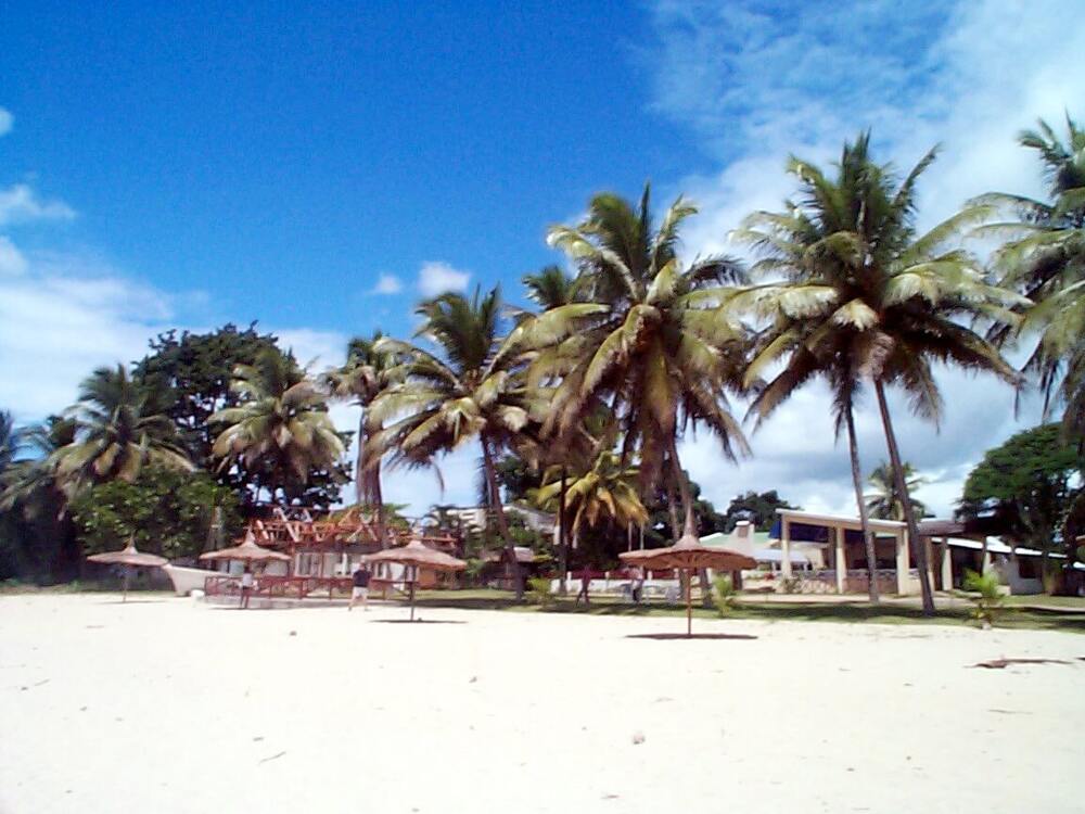
- The Soavoanio coconut grove, with an area of about 5000 ha belonging to the Sambava Voanio Company;
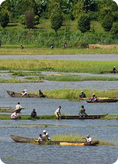
- The descent by canoe or canoe of the Bemarivo River which flows into the Indian Ocean. Bemarivo is the northern limit of the Betsimisaraka territory;
- The fishing village of Antohomaro near Lake Andohabe, the waterfall of Ampijoroa; the bay of Vohémar with its breathtaking landscape with its coral reef belt and kilometers of beach ;
- The Green Lake of Andranotsara, 7 km south of Vohémar, known for its sacred crocodiles;
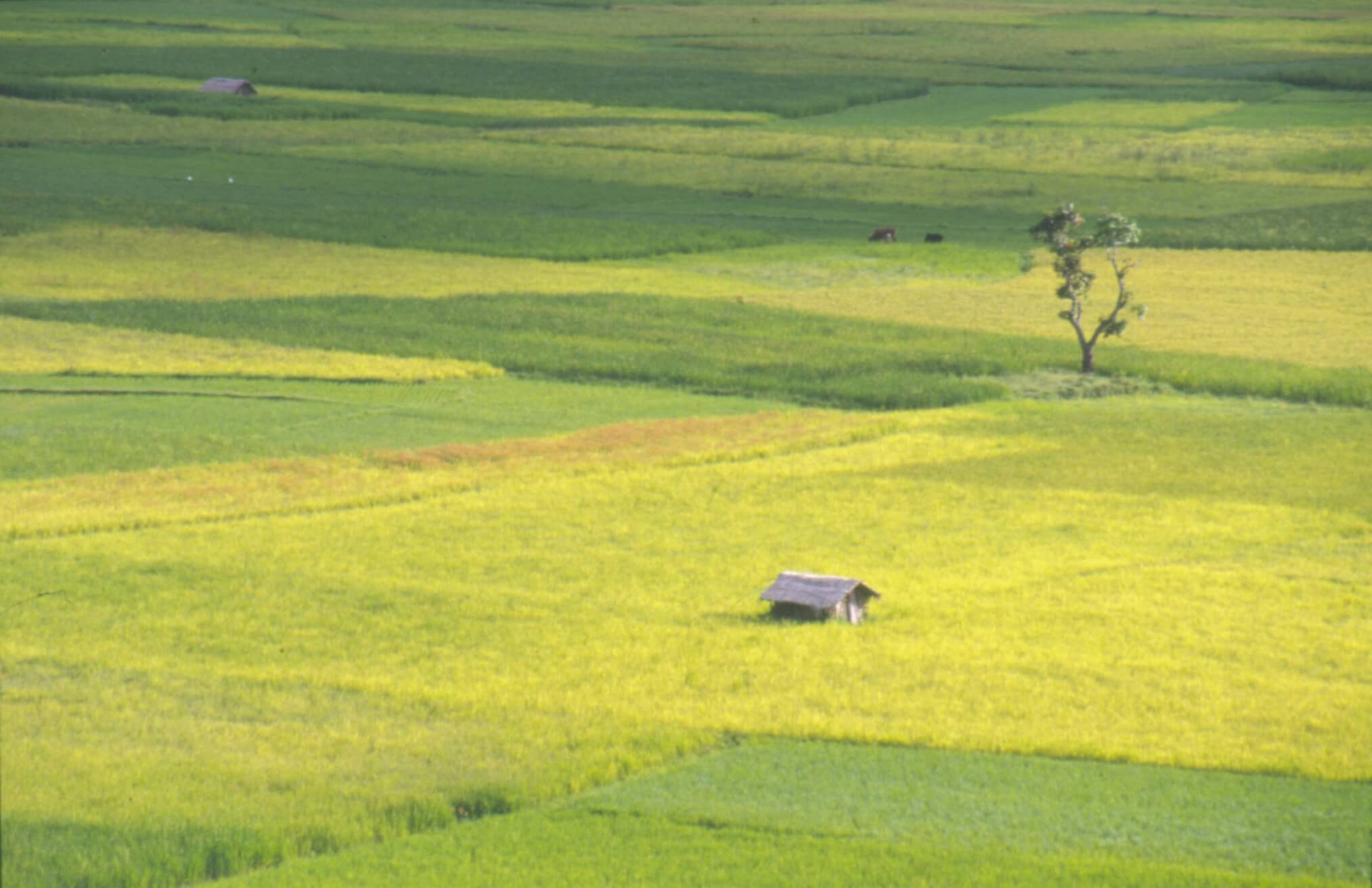
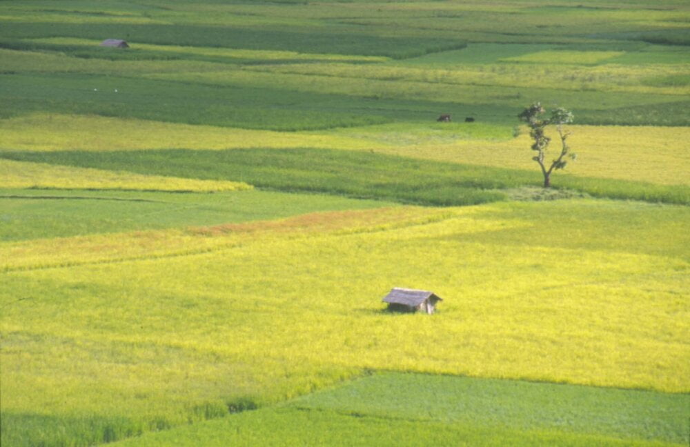
- The rice fields of the Andapa basin which is the rice granary of the SAVA Region.
Gallery

See also other regions
Historically, Alaotra comes from the name of the large Lake Alaotra located in the middle of the Districts of Ambatondrazaka and Amparafaravola (the largest lake in Madagascar) while Mangoro is the name of the main river crossing Moramanga and Anosibe An’Ala from North to South. The Alaotra Mangoro Region is located on the highlands, about […]
The Amoron’i Mania Region located in the central part of the Southern Highlands (province of Fianarantsoa) consists of four (4) districts, namely Ambatofinandrahana, Ambositra, Fandriana and Manandriana. The region is limited to the north: by the Vakinankaratra region; to the east the region of Vatovavy Fitovinany and; to the south, by the region of Matsiatra […]
Antananarivo Renivohitra is the capital of the Analamanga Region. Antananarivo Renivohitra is the capital of the Analamanga Region. Located in center, and covering an area of 17,448 km². It is bounded by 5 regions: Betsiboka in the North, Itasy and Bongolava to the west, Alaotra Mangoro to the east and Vakinankaratra to the south. By […]
Also known as the “Malagasy capital of cloves1″, the Analanjirofo Region is located in the northeastern part of Madagascar and covers a perimeter of 22,384 km2. It is bounded by: – to the north by the district of Antalaha (SAVA Region); – to the south by the district of Toamasina II (Atsinanana Region) to the […]