


Antsirabe

Antsirabe is the third largest city in Madagascar and the capital of the Vakinankaratra region, In Madagascar, Antsirabe is known for its relatively cool climate (like the rest of the central region), its industry and the high concentration of pulled rickshaws or pousse-pousse. It attracts around 30,000 tourists a year. The area where Antsirabe is found today was part of the Kingdom of Andrantsay which existed from the early 1600s until it was incorporated into the Imerina kingdom in the early 1800s. The area was a farming region, with production of rice, vegetables and fruit. The city was founded by Norwegian missionary T.G. Rosaas in 1872 as a hill station to serve as a retreat centre because of the much cooler climate. The thermal baths were opened in 1917.In 1886 the Norwegian mission established the leper hospital of Ambohipiantrana and it quickly developed into a village for lepers.
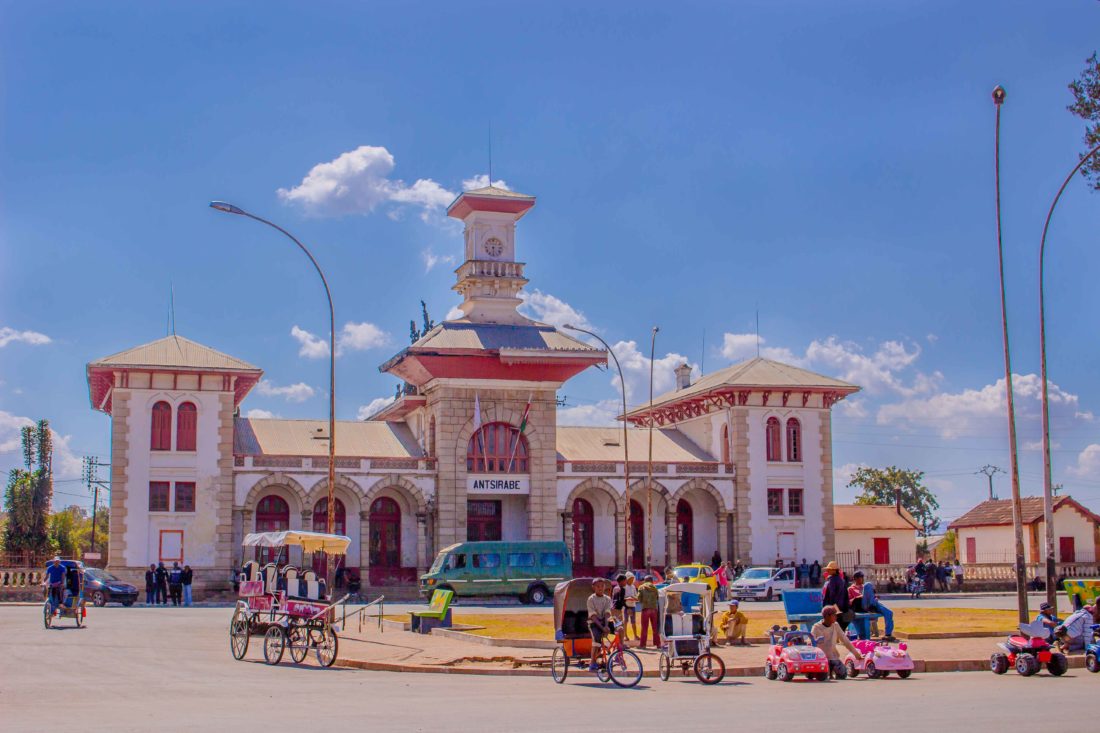
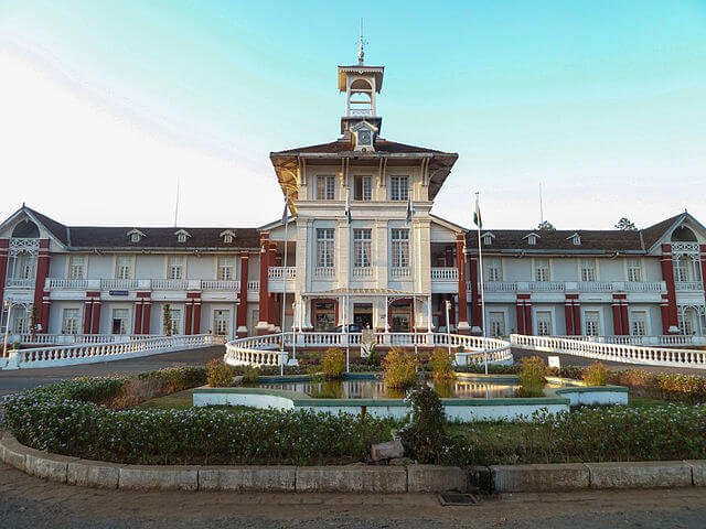
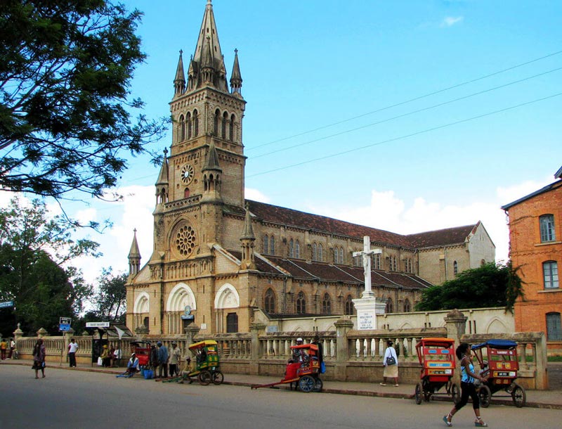
The colonial government decided to make it the leper hospital of Vakinankaratra and the around 950 people with the illness lived there in 1904. During the French colonial rule the centre of the Vakinankaratra region shifted from the Andrantsay capital of Fivavahana to Antsirabe.In 1921 it succeeded Betafó as the seat of a Catholic (pre-diocesan) Apostolic vicariate, and was promoted to a bishopric in 1955. Several buildings in central Antsirabe date back to the first decades of the 20th century. These include the thermal bath centre (opened in 1917), Hôtel des Thermes (1922), the railway station (1923), and the residence for French retirees (1934).
Other sights are la Stèle de l’Indépendance (the Stele of Independence) on Independence Avenue and the two public markets: Antsenakely (“The Small Market”) and the bigger Asabotsy. Antsirabe is situated at an altitude of about 1,500 m (4,900 ft), making its subtropical highland climate (Köppen: Cwb), similar to Brazilian high cities of the southeast. During the winter the temperature can fall below 0 °C (32 °F) at night, and Antsirabe has recorded the lowest temperature in Madagascar at −1.0 °C (30.2 °F). May to September form the coldest and driest part of the year with average monthly temperatures between 14 °C (57 °F) and 17 °C (63 °F) and an average number of days with precipitation per month of 1–2. From November to March the climate is warmer and wetter with on average 12 to 17 days with precipitation per month and average temperature of approximately 20 °C (68 °F)
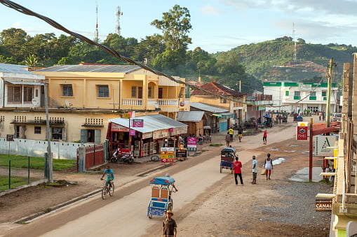
April and October have average temperatures of 19.2 °C (66.6 °F) and 18.5 °C (65.3 °F) respectively and 5–6 days of rain.]The Ankaratra volcanic field covers an area about 100 km long from Antsirabe northwards to Arivonimamo where highest peak reaches 2,644 m (8,675 ft). This volcanic field is “the most prominent and volcanologically diverse (sic) on Madagascar”. Several water-filled craters are found in the area around Antsirabe, including Lake Tritriva to the south-west. There are hot springs which are utilised by the Ranomafana thermal bath in the city.The Mania River is south of Antsirabe. The city is at the end of the TA (Tananarive-Antsirabe) railway line, part of the Network North railway, which links Antsirabe to the capital and the port city of Toamasina. The line is operated by Madarail, currently only with freight trains. The line has been extended southwards through Vinaninkarena, but this extension is not in use.National road 7 (RN7) connects the city to Antananarivo in the north and to Fianarantsoa and Toliara to the south. Antsirabe is connected with Morondava on the west coast through RN34 and RN 35.Public transport to and from Antsirabe are provided by taxi-brousses (share taxis) and buses. Most taxi-brousses operate from the main bus station in the north of the city. Within the city public transport consists of small buses and numerous pulled rickshaws (“pousse-pousse”), as well as cycle rickshaw (“cyclo-pousse”), auto rickshaw (“touktouks”) and private taxis. The pousse-pousse is something of an emblem of the city; 5600 of them were recorded in 2006.
Gallery

See also other city
About fifty kilometers south of Fianarantsoa, Ambalavao is revealed timidly nestled between the granite mountains, dominated by the Andringitra massif and Boby Peak peaking at nearly 2,658 meters of altitude. This region marks the boundary between the Highlands and the southern part of Madagascar, represented by three rocky massifs designated as the gates of the […]
Ambanja is the capital town of the district by the same name in the northwest of Madagascar. The town is located along the beautiful Sambirano River, about 20 kilometres from the Mozambique Channel, southeast of Nosy Be island. Ambanja is the heart of the Sambirano region, which comprises the area along the course of the […]
Ambatoboeny is a town in north-western Madagascar in Boeny Region
Ambatofinandrahana is a municipality in Ambatofinandrahana District in central Madagascar. It is a part of Amoron’i Mania region. his town lies at the Route nationale 35 from Morondava to Ivato at 67 km from Ivato. he protected area of the Massif d’Itremo. The only quartzite and marble quarries of Madagascar are found within 40km from […]