


Analanjirofo

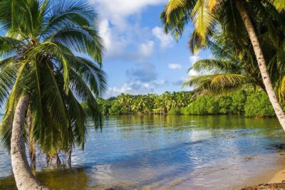
Also known as the “Malagasy capital of cloves1″, the Analanjirofo Region is located in the northeastern part of Madagascar and covers a perimeter of 22,384 km2. It is bounded by: – to the north by the district of Antalaha (SAVA Region); – to the south by the district of Toamasina II (Atsinanana Region) to the west by the districts of Mandritsara (Sofia Region), Andilamena and Ambatondrazaka (Alaotra Mangoro Region); and to the east by the Indian Ocean. It is also bounded by the following geographical coordinates: – between 16°30’27” and 16°30′ south latitude; – between 49°31’40” and 49°31′ east longitude. The Analanjirofo Region is subdivided into 6 districts namely: Fenerive-East, Maroantsetra, Manana ra-North, Soanierana Ivongo, Sainte-Marie and Vavatenina. The capital of the region, Fenerive-Est, is located 475 km northeast of the capital and is connected to it by the RN2 and then the RN52. The region is subject to an oceanic influence and a very high estimated rainfall, , the average rainfall being estimated at 2000 mm per year. It has extensive forest cover, protected parks and thriving tourism activities in some of its districts.
The site of “Tampolo”, located in the municipality of Ampasina Maningory, with an area of 675.46 ha. The management objectives pursued on this site are the conservation of biodiversity, the maintenance of ecological services and the sustainable use of natural resources. *
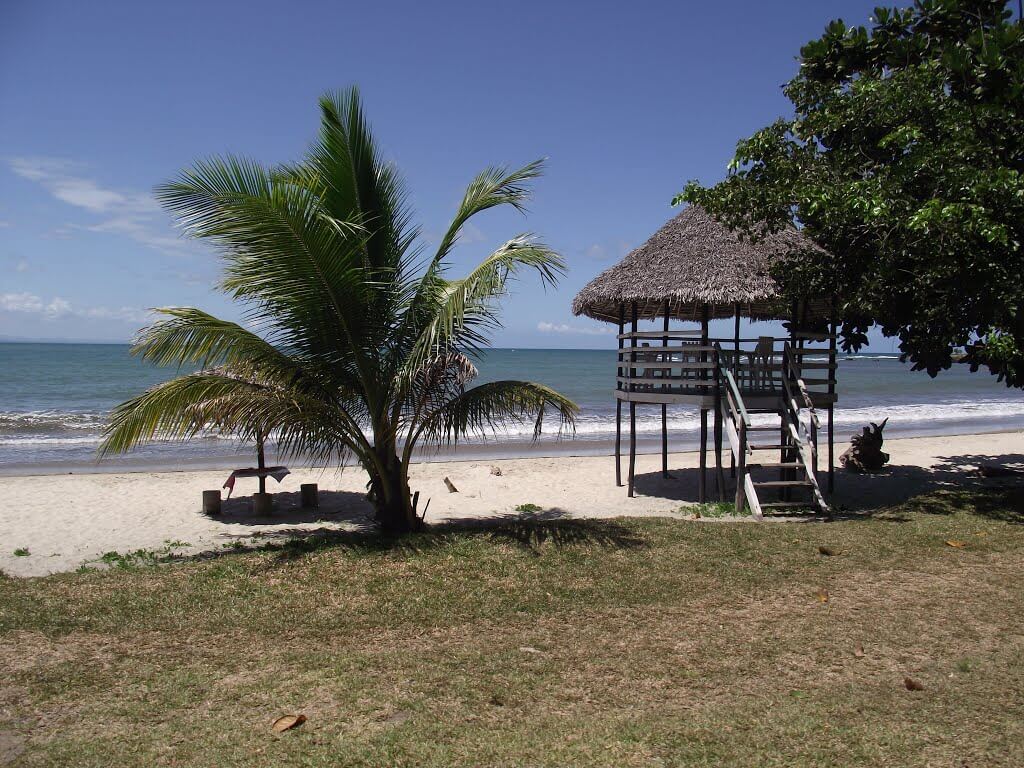
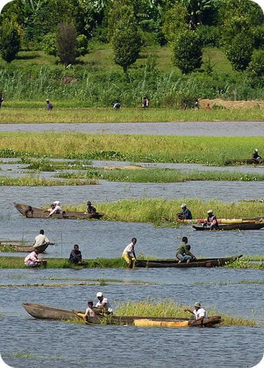
The average annual temperature is about 24 °C. The average highs of the hottest month are around 27 °C and the highest temperatures are recorded in December and February. The minimum of the coldest month hovers around 14°C. The average minimum is between 16 and 17 °C during the months of July, August and September. Fishing activities are present in some municipalities of the region and especially those located by the sea. Thus, Sainte-Marie is very active in this field since it practices industrial fishing, coastal fishing and fish farming. . In Maroantsetra, in addition to coastal fishing, all its municipalities practice freshwater fishing, compared to 20% for fish farming, and 50% for industrial fishing. The municipalities of Fenerive-Est are distinguished by the practice of almost all types of fishing, however there is no industrial fishing activity. . In the district of Vavatenina, the majority of municipalities are engaged in fish farming, compared to only 30% for freshwater fishing. Finally, in Mananara Avaratra, a few municipalities are engaged in freshwater fishing (14.2%) and inshore fishing (28.5%) as well as in Soanierana Ivongo (37.5%).
The National Parc Masoala :
The largest park at the national level is home to a highly varied endemicity of fauna and flora.
This national park is managed by ANGAP and WCS. Thanks to its eco-tourism products, it can contribute significantly to boosting the tourism sector and thus allow permanent arrival many tourists. Masoala Regenwald, or Espace Masoala, is an exciting initiative which will ensure a long-term partnership between Zurich Zoo and Masoala National Park. Approximately one hectare of the Masoala peninsula has been recreated, in a huge greenhouse in Zurich and filled with unique animals from the region. Zoo visitors will enjoy the experience a crossing in a tropical forest and will have the opportunity to learn the fascinating diversity biological and cultural of Madagascar. The greenhouse functions as a permanent “showcase” which will encourage people to visit Madagascar, and to contribute directly to the protection of the biodiversity of Masoala.
Antongil Bay :
With its area of 2800 km2 is the largest bay on the East Coast. It is also one of the most important whale breeding areas in the south-eastern Indian Ocean. This locality of 20,000 inhabitants is the starting point for many excursions on foot, by boat, and even in kayak to Nosy Mangabe and the huge Masoala National Park.
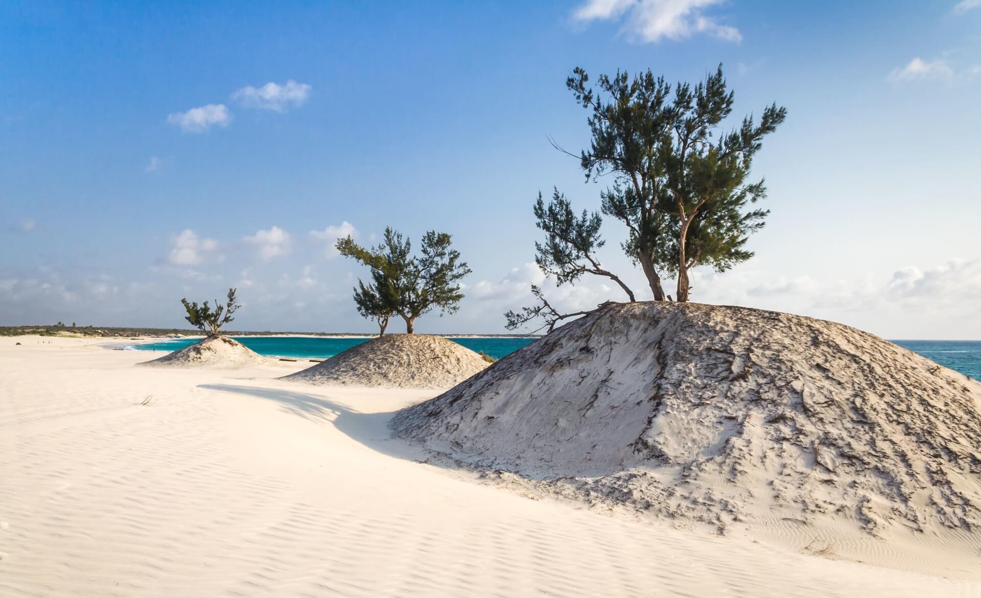
Nosy Boraha :
This island of 60 km long and 5 km maximum wide is a true sanctuary of nature with its primitive forests, floral species, waterfalls, seabed and famous humpback whales that meet there from June to September
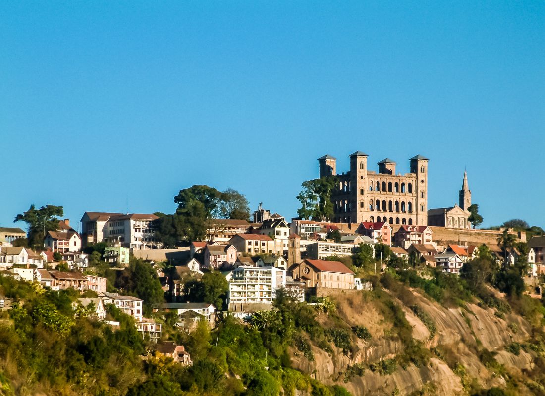
Fenoarivo Atsinanana :
16 km from Mahabo is nicknamed the city with the scent of cloves
Gallery

See also other regions
Historically, Alaotra comes from the name of the large Lake Alaotra located in the middle of the Districts of Ambatondrazaka and Amparafaravola (the largest lake in Madagascar) while Mangoro is the name of the main river crossing Moramanga and Anosibe An’Ala from North to South. The Alaotra Mangoro Region is located on the highlands, about […]
The Amoron’i Mania Region located in the central part of the Southern Highlands (province of Fianarantsoa) consists of four (4) districts, namely Ambatofinandrahana, Ambositra, Fandriana and Manandriana. The region is limited to the north: by the Vakinankaratra region; to the east the region of Vatovavy Fitovinany and; to the south, by the region of Matsiatra […]
Antananarivo Renivohitra is the capital of the Analamanga Region. Antananarivo Renivohitra is the capital of the Analamanga Region. Located in center, and covering an area of 17,448 km². It is bounded by 5 regions: Betsiboka in the North, Itasy and Bongolava to the west, Alaotra Mangoro to the east and Vakinankaratra to the south. By […]
Located in the southwest of Madagascar, the Androy Region is located in the extreme south of Madagascar. It occupies the territory between the rivers Mandrare to the east and Menarandra to the West. It is bounded to the north by the mountainous foothills of the Bara Southern Highlands and to the south by the Indian […]