


Betsiboka
The Betsiboka region is located in western Madagascar, it constitutes the south-central part of the province of Mahajanga and has a subsoil rich in various minerals: gold being the most present since the gold zone constitutes nearly 40% of the territory but also chromite, gypsum and quartz. Delimited:
- to the north by the region of Boeny
- to the north-east by the Sofia region;
- to the east by the region of Alaotra-Mangoro;
- in the south by the regions of Analamanga and Bongolava;
- and to the west by the Melaky region
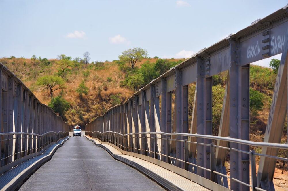
It is subdivided into three districts: Kandreho, Maevatanana and Tsaratanana. The capital of the region is Maevatanana. The Betsiboka River, the largest river in Madagascar, flows through the capital of Madagascar. The region which is located 315 km northwest of the capital and is connected with it by the RN4.
The region covers an area of 30,025 km2 and accounts for 5% of the total area of Madagascar. The Betsiboka region is located in a transition zone between the Malagasy highlands, of which it is bordering, and the coastal region of Boeny opens onto the Mozambique Channel. It is characterized by rugged semi-mountainous terrain, massive rock outcrops and flat expanses not exceeding 800 m above sea level. Topographically, it has an altitude between 50 m and 1,545 m. There are four main types of landscapes1:
- the Baiboho covering more than 10,000 ha and along the rivers of Menavava, Ikopa and
- Betsiboka
- the Hara with rather rugged relief more or less rocky;
- sandy-sandstone zones: transition between plateau and Baiboho;
- the Middle West, part of the Tampoketsa, extension of the high-plateau zone between 600 and 1,000 m above sea level.
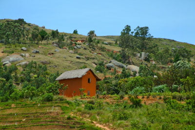
The landscape of Kandreho is characterized by hills and plateaus. The climate of the region is tropical dry with alternating between a dry season of 7 months from April to November and a wet season of 5 months from November to April. In contrasting seasons where the heat is constant, the average annual temperature, relatively high compared to other regions is 28 °C with an amplitude of 12 °C. Classified among the hottest region of Madagascar, the maximum temperature can reach 40 to 42
The population is cosmopolitan and is composed mainly of “the Merina (45%), the Sakalava (21%), Betsileo (16%) and Antaisaka (12%).” Because the region is acrossroads to access the North and the extreme West of the island in particular, we can find all kinds of ethnic groups including those of the nearby regions: the Tsimihety and the Antandroy. The Betsiboka Region, a must to reach the far west and north-west of Madagascar is rich in tourist sites and products despite the poverty of its road infrastructure whichmakes many of its communes virtually landlocked. The Kasijy Special Reserve, with an area of 19,800 ha, extends west of the Mahavavy River. It has 15 species of mammals, 22 species of reptiles and 67 species of birds of these bird species, five are listed by the International Union for Conservation of Nature (IUCN). These species are almost all endemic to Madagascar and are for the forest majority.
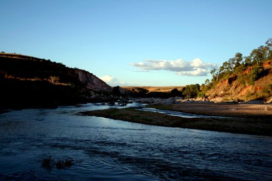
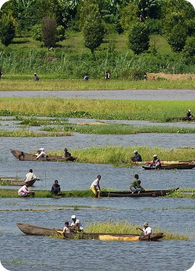
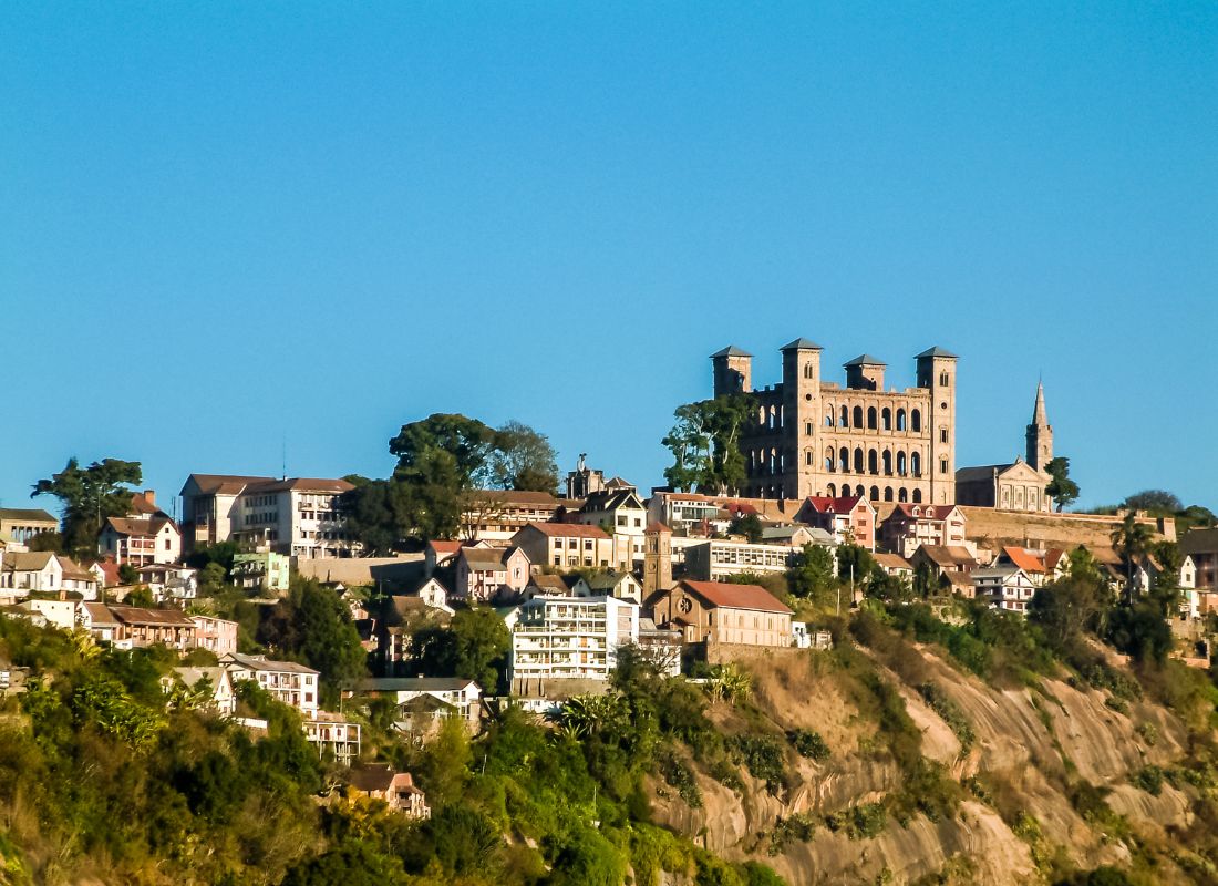
The Betsiboka River, the largest river in Madagascar, is also one of the region’s curiosities.It is characterized by its tumultuous falls and its reddish color due to the impressive amounts of land it carries. The city of Maevatanana, one of the hottest cities in the country, has an important relay of bush taxis that connects the axis Antananarivo and Mahajanga. There are beautiful models of classical architecture – such as the monument of the French dating from 1895 and a market rich in crafts and Mining products.
Gallery
See also other regions
Historically, Alaotra comes from the name of the large Lake Alaotra located in the middle of the Districts of Ambatondrazaka and Amparafaravola (the largest lake in Madagascar) while Mangoro is the name of the main river crossing Moramanga and Anosibe An’Ala from North to South. The Alaotra Mangoro Region is located on the highlands, about […]
The Amoron’i Mania Region located in the central part of the Southern Highlands (province of Fianarantsoa) consists of four (4) districts, namely Ambatofinandrahana, Ambositra, Fandriana and Manandriana. The region is limited to the north: by the Vakinankaratra region; to the east the region of Vatovavy Fitovinany and; to the south, by the region of Matsiatra […]
Antananarivo Renivohitra is the capital of the Analamanga Region. Antananarivo Renivohitra is the capital of the Analamanga Region. Located in center, and covering an area of 17,448 km². It is bounded by 5 regions: Betsiboka in the North, Itasy and Bongolava to the west, Alaotra Mangoro to the east and Vakinankaratra to the south. By […]
Also known as the “Malagasy capital of cloves1″, the Analanjirofo Region is located in the northeastern part of Madagascar and covers a perimeter of 22,384 km2. It is bounded by: – to the north by the district of Antalaha (SAVA Region); – to the south by the district of Toamasina II (Atsinanana Region) to the […]