


Melaky

Located on the western central coastal part of Madagascar between North-South, the Melaky Region has various potentialities such as agriculture, livestock, fishing and ecotourism. It is administratively bounded to the north by the region of Boeny, to the east by the region of Betsiboka, to the south-east by the Bongolava region, to the south by the Menabe region and to the west by the Canal of Mozambique. The Melaky Region covers a total area of 36,269 km2 and is home to 5 districts in total:Maintirano, Antsalova, Morafenobe, Ambatomainty and Besalampy. The surface is distributed as follows: The district of Besalampy occupies the largest area of the territory (33.12%) followed by Maintirano (27.14%) and Morafenobe (20.53%).
The eastern part which constitutes the hinterland is formed by plateaus extending over an area of 200 to 300 m altitude. We thus meet the plateaus of Bemaraha and Bongolava as well as the causes of Kelifela. The Bemaraha plateaus are home to a unique geological formation called “the Tsingy de Bemaraha”.
It is a set of sharp limestone ridges and peaks resulting the corrosive action of rain, constituting one of the most spectacular landscapes in the world.
- the western part is formed mainly by the coastal plain consisting of large alluvial valleys with lakes and ponds frequently flooded during the rainy season. This is the part that lends itself best to different forms of agriculture thanks to good soil quality.
The climate of the region is tropical and is characterized by the existence of two very seasonal seasons. contrasts: a hot and rainy season that lasts 5 to 6 months, from November to April and a cool and dry season that extends over 6 to 7 months of the year, from May to October.The average daily temperature varies between 18 and 31 °C. The lowest average is in June (18.7°C), highest in March (31.7°C). The relatively high thermal amplitude allows the practice of agriculture with a good amount of rain. Average temperature.
In general, the Sakalava are the majority in the region. However, there are other fringes such as the Antaisaka, Betsileo, Bara, Tsimihety, Antandroy and Merina. In the Melaky Region, tourism is a driver of rapid development thanks to the presence of famous tourist sites. The following sites include the following sites:
- the National Park of Tsingy de Bemaraha which includes several tourist sites including the famous Manambolo Gorge. The park is also rich in biodiversity and endemic species of Madagascar;
- its complex of protected areas classified as a World Heritage site and used as a eco-tourism zone for its enhancement the Befotaka-Soamalipo-Ankerika lake complex and Lake Antsamaka classified as “SitesRamsar” thanks to its exceptional faunal diversity and environmental quality;
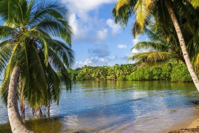
- the beautiful seaside sites specified by small islands (the Bahrain Islands) having beautiful beaches and rich in biodiversity.
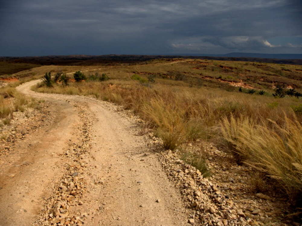
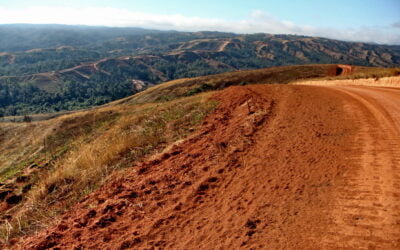
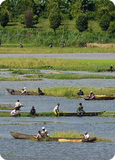
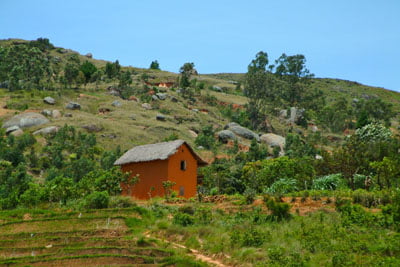
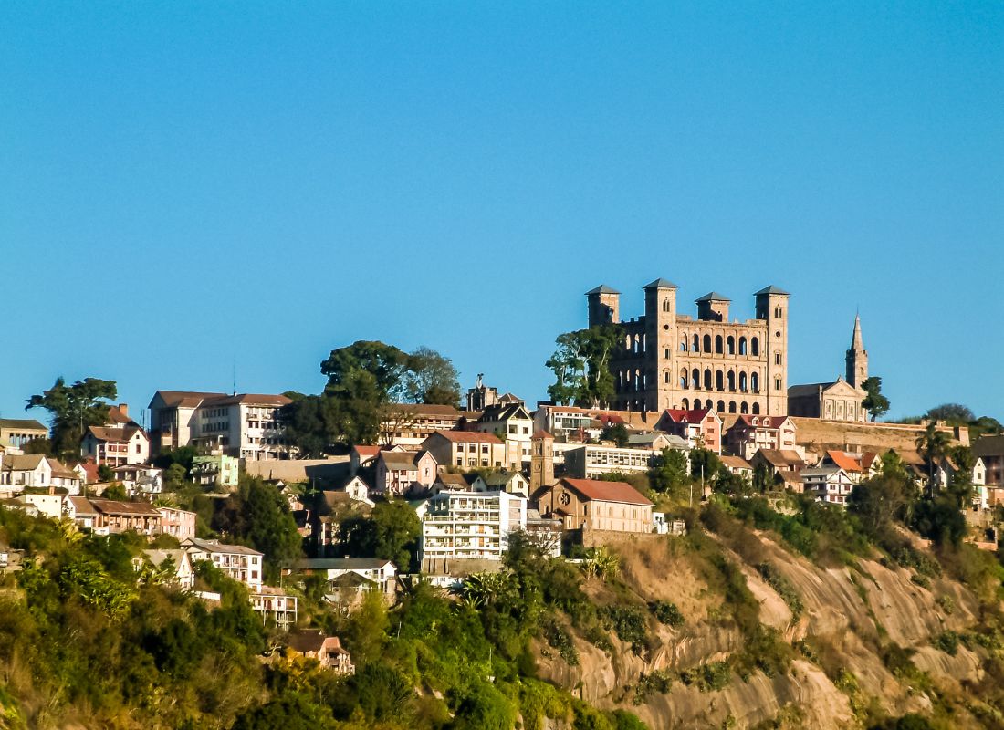
Gallery

See also other regions
Historically, Alaotra comes from the name of the large Lake Alaotra located in the middle of the Districts of Ambatondrazaka and Amparafaravola (the largest lake in Madagascar) while Mangoro is the name of the main river crossing Moramanga and Anosibe An’Ala from North to South. The Alaotra Mangoro Region is located on the highlands, about […]
The Amoron’i Mania Region located in the central part of the Southern Highlands (province of Fianarantsoa) consists of four (4) districts, namely Ambatofinandrahana, Ambositra, Fandriana and Manandriana. The region is limited to the north: by the Vakinankaratra region; to the east the region of Vatovavy Fitovinany and; to the south, by the region of Matsiatra […]
Antananarivo Renivohitra is the capital of the Analamanga Region. Antananarivo Renivohitra is the capital of the Analamanga Region. Located in center, and covering an area of 17,448 km². It is bounded by 5 regions: Betsiboka in the North, Itasy and Bongolava to the west, Alaotra Mangoro to the east and Vakinankaratra to the south. By […]
Also known as the “Malagasy capital of cloves1″, the Analanjirofo Region is located in the northeastern part of Madagascar and covers a perimeter of 22,384 km2. It is bounded by: – to the north by the district of Antalaha (SAVA Region); – to the south by the district of Toamasina II (Atsinanana Region) to the […]