


Menabe

The Menabe Region (literally, “the Great Red”) owes its name to the color of its rivers loaded with laterite. Located in the southwestern part of Madagascar, it covers 46,121 km2. It also has a coastline that stretches 350 km long off the Mozambique Channel.Numerous islets and sandbanks separate the coast from the high seas, namely (from the South to the North) : – between Andranompasy and Belo sur Mer, the islets of Andriamitoraka, Mailolo, Angoraoky, Nosibe or Andriangory;
- between Belo sur Mer and Morondava: the islets of Nositiana, Motsadiniky, Andravoho;
- between Morondava and Belo-sur-Tsiribihina;
- the sandbanks of Cordelière-Moines – Marjolaine and the Tsiribihina pit.
The Menabe Region is subdivided into 5 districts namely: Belo-sur-Tsiribihina, Mahabo, Manja, Miandrivazo and Morondava. Morondava, the district capital is located 646.1 km from the capital.
It is connected to it by the R.N 7 to Antsirabe, from there, by the RN 34 to Malaimbandy, and from Malaimbandy to Morondava, by the RN 35. The Menabe Region offers a diverse landscape composed of:
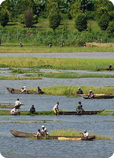
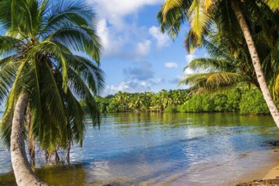
coastal areas: mangroves cover almost the entire coastline and are of paramount importance for the population living from gathering. In particular, they facilitate fishing crab, as well as traditional or artisanal fishing. Mangroves are also used as firewood and timber for buildings. The plains: the vast expanses can receive both irrigated and irrigated speculations others that retain rainwater (beans, Cape peas, lentils, tsiasisa, corn); There are the plateaus of Bemaraha and Besabora. These are vast high plains, agro-pastoral zones straddling the districts of Belo-sur-Tsiribihina and from Miandrivazo from north to south, extending south to join Besabora in full middle of Mahabo district via Malaimbandy. The massifs: two massifs are present in the region namely the Bongolava Massif (point culminating: 1,342 m, between Ankavandrakely and Tsiroanomandidy), the Makay Massif (point culminating: Andranomita, at 1,034 m).He main lakes are on the Betsiriry and along the Tsiribihina River: Betsiaky (Anosimena), Anketrevo, Asonjo (Anosimanitsy, Ankotrofotsy), Andranomena (Ankalalobe), Andranomena (Begidro), Hima (Amboloandro), Kimanomby (Andranomandeha, Ambohibary), Iboboka, Saririaka (Masoarivo).
The “Bloc” West, from Antsiranana to Morondava, presents, in the year, two clearly decided climatic seasons: a hot and rainy season, from November to April and a less hot season and very dry, from May to October. The Menabe is thus characterized by a semi-arid tropical climate in short rainy season. The drought is increasing from north to south, but is mitigated by west to East due to altitude.
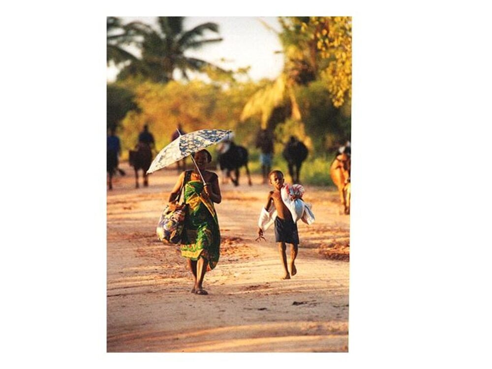
The average annual temperature is about 24 °C. The average of the maxima of the month most hot is around 31.9 °C while the average minimum is 17.5 °C. The region corresponds to the ancient kingdom of Menabe (composed of Sakalava). Later, she is become multiethnic since there are currently more than 10 ethnic groups including: Sakalava, Bara, Antesaka, Vezo, Betsileo, Antandroy, Mahafaly, Masikoro, Antalaotse, Merina, Tanosy. The Menabe remains an ancient migration area. The Menabe Region is a very popular tourist destination due to its location
The very history of Menabe. Miandrivazo Located on the banks of the Mahajilo River, a tributary of the Tsiribihina, Miandrivazo is very steep. Wedged between the Bongolava chain to the east and the Bemaraha plateau to the west, this situation ensures the status of “the hottest city in Madagascar” with an annual average of 28 ° C.
The passage of gorges through the Bemaraha massif is one of the highlights of the descent. The arrival is at the landing stage of Sémaria or Tsimafana with possibility to reach Morondava by Taxi-brousse.
Malaimbandy. It is located near the Sakeny valley whose waters will meet the Tsiribihina. Malaimbandy does part of the Sakalava kingdom of Menabe. As a curiosity, there is the Colona house (not of an old governor who spent his weekends there) located in a pleasant place in Ankoboka. We can eat at the Hotely Menabe: small gargote without comfort, two bedrooms, Malagasy meal.
Mahabo means “who is exalted”. It is 43 km from Morondava, on the RNS 35. Former royal village of Tsima Nongarivo, king Sakalava of the early eighteenth century century renowned for its cruelty, then Merina stronghold, Mahabo houses the palace of Queen Narova (second mid-nineteenth century) and the tomb of Ratsikiloly, great soothsayer of Sakalava royalty. That last monument can not be visited.
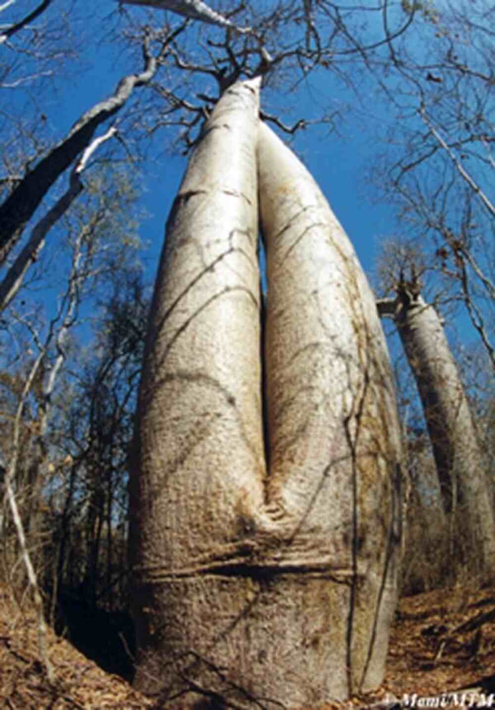
Note near Mahabo, the existence of majestic baobabs: sacred Baobab. The baobabs are one of the main natural curiosities of western Madagascar. An impressive specimen stands on the right side of the RNS 35, just outside Morondava. It is a place of worship where people come to honor the ancestors by depositing conch, bottles and red and black fabrics in the crevices of its trunk.Hot springs Menabe, Manamby and Tsiarozava are also in Mahabo district. The royal necropolis of MANEVA in Ankilivalo is part of the site of Mahabo. It houses the tomb of the king Andriandahifotsy.
Morondava ,economic and administrative capital of Menabe, Morondava is located on the river delta of the same name. The city has always been struggling with the sea. It also conceded 2 km of rich cultivated plains (Mahamasy and Betsimpagnato) to the place called “the Betania pass” in the space of only a century and a half. There are the following tourist sites :
- North of Morondava: The alley of baobabs (19 km). Spectacular settlement of baobabs (Andansonia grandidieri) locally called “Reniala”, located at the beginning of the track of Belo-sur-Tsiribihina. (Flowering period between February and March, yellow flowers) Sakalava – Vezo burial sites: The visit of these burial sites is subject to prior authorization issued by the Local Government. It is imperative to be accompanied by a guide because in addition to the difficulties of access, many taboos (Fady) protect these sites;
- Tombs of Mangily (North): Accessible only in the dry season due to the area Swamp;
- Tombs of Ambato sur mer and Kivalo (North): Access possible by canoe only. Kivalo is a village of the famous sculptor Rasidany;
- Tombs of Lovobe (South): Accessible only by canoeTsiringy Forest or “Swiss Forest” (60km on the road to Belo-sur-Tsiribihina): Tours signposted pedestrians with identification of tree species. Possible accommodation in rustic bungalows.
Andranomena reserve (about fifty km north of Morondava): It covers several tens of hectares of dry forest and home to eight families of lemurs, other endemic mammals, reptiles (crocodiles, snakes and turtles, including Pixys planicauda, which lives only in this forest) and forty-five species of birds.
Belo-sur-Mer
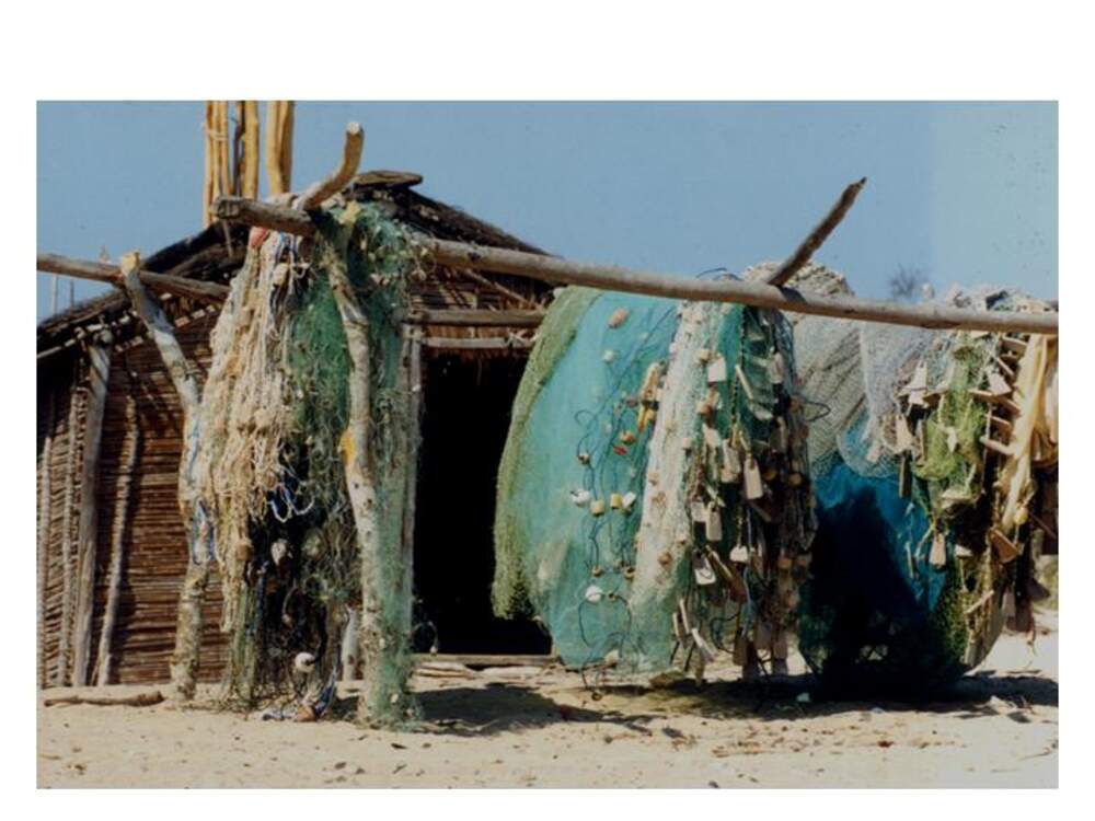
This charming fishing village and schooner builder is accessible by land (80 km) but especially maritime (2 hours crossing) from Morondava. Its beautiful beach invites you to idleness, while its lagoon attracts windsurfers and diving enthusiasts, especially since it serves as a refuge for sea turtles. With the agreement of the local authorities, it is also possible to reach by canoe or schooners Nosy Andrahovo, Nosy Tania, Nosy Andriangory and Nosy Angarahoka. East of Belo/ Sea, the forest reserve of KIRINDY offers multiple opportunities for walking to those who want to observe lemurs, chameleons, butterflies and birds.
Ankevo sur mer: Small fishing village located between Morondava and Belo/Mer; beautiful reef coralline. Access in dry season only.
La Marina de Belo: Beautiful hotel structure, bungalow by the sea, pool restaurant, Water activities.
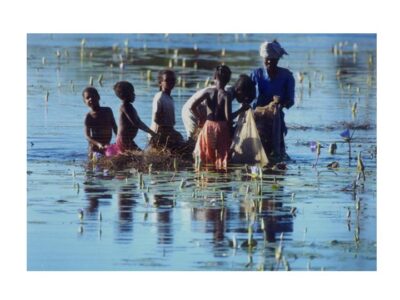
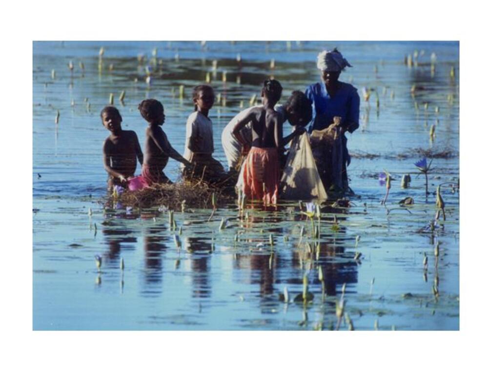
Manja is located inside the Sakalava country of Menabe, the city was in the nineteenth century the capital of a small kingdom. The Village of Bengy (Goat) about 70 km southwest is a historic village, for it was there that Andrimandazoala, son of a Mahafaly king and who founded the dynasty, settled of the Maroseranana. All the rulers of the two great Sakalava kingdoms (Menabe and Boina) in are issued. Among other scenic spots, there is Ikomby’s Cave in Betalatala former refuge of the “vazimba”, the marsh of Bekola and its sacred eel, the tamarind tree of Tsimanango revered by the “dahalo”, the beach of Andranompasy located 70 km west of Manja. This village located on the estuary of the Tsiribihina houses the sanctuary where are preserved the relics of the ancient kings of Menabe. These relics, or “dady” (fingernail, occipital bone, canines of the upper jaw, taken from the deceased), are the object of special veneration; in the past, they legitimized the power of their holder. Periodically, since the end of royalty, the “dady” are bathed in great ceremony in the Tsiribihina. This ritual of the “bath” or fitampoha, which lasts a week, allows participants to relive the Sakalava story. Offerings and sacri-131
These funds made on this occasion are intended to guarantee the protection of royal ancestors and prosperity of Menabe.
- Royal tombs of Tsianihy (East of Belo-sur-Tsiribihina. These tombs contain the body of King Toera as well as those of Princes Peter and George Kamamy. King Toera was killed along with his warriors in August 1897 during the attack on the royal village of Ambiky by the French troops of Commander Gerard, who wanted to obtain the surrender of the Sakalava of the Menabe.
- Manambolo Gorges a 50 km seasonal track connects Belo-sur-Tsiribihina to Bekopaka, a riverside village of Manambolo and southern gateway to the Bemaraha reserve (classified as a World Heritage Site by UNESCO) and its totally preserved “Tsingy”. Upstream of Bekopaka, the river has carved gorges spectacular in the limestone plateau of Bemaraha. Some of the caves that open on the side of Cliffs are ancient Vazimba necropolises. Bemaraha Strict Nature Reserve
The Tsingy du Bemaraha reserve is the largest protected site in Madagascar (152,000(a). It is almost 90 km long and between 10 and 20 km wide. She covers the boundaries of a vast limestone plateau that rain erosion has bristled in spectacular lapiaz, sharp ridges and ridges that bear the name of “Tsingy” in Malagasy. The massif contains many caves and resurgences. The sinkholes and avens,in places, this eroded karst are the only islands of greenery in this mineral universe, Sanctuaries for the Western Dry Forest. Also in the directory of tourist sites that exist in the region, we can mention the sites identified but not yet exploited, the tourist sites operated to date and newly identified, valued and promoted sites of tourist interest
Gallery

See also other regions
Historically, Alaotra comes from the name of the large Lake Alaotra located in the middle of the Districts of Ambatondrazaka and Amparafaravola (the largest lake in Madagascar) while Mangoro is the name of the main river crossing Moramanga and Anosibe An’Ala from North to South. The Alaotra Mangoro Region is located on the highlands, about […]
The Amoron’i Mania Region located in the central part of the Southern Highlands (province of Fianarantsoa) consists of four (4) districts, namely Ambatofinandrahana, Ambositra, Fandriana and Manandriana. The region is limited to the north: by the Vakinankaratra region; to the east the region of Vatovavy Fitovinany and; to the south, by the region of Matsiatra […]
Antananarivo Renivohitra is the capital of the Analamanga Region. Antananarivo Renivohitra is the capital of the Analamanga Region. Located in center, and covering an area of 17,448 km². It is bounded by 5 regions: Betsiboka in the North, Itasy and Bongolava to the west, Alaotra Mangoro to the east and Vakinankaratra to the south. By […]
Also known as the “Malagasy capital of cloves1″, the Analanjirofo Region is located in the northeastern part of Madagascar and covers a perimeter of 22,384 km2. It is bounded by: – to the north by the district of Antalaha (SAVA Region); – to the south by the district of Toamasina II (Atsinanana Region) to the […]